人人都懂物联网
一个免费&专业的 AIoT 创客技术知识库


Arduino
Arduino 开发入门教程

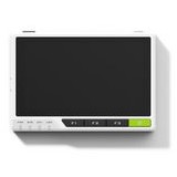
Wio Terminal
好玩的物联网开发套件
树莓派
树莓派开发入门教程

BeagleBone Black
基于 TI3355 的开源开发板
STM32
丰富的 STM32 学习资料
STM32 MPU
STM32MP1 开发教程
NodeMCU
基于 ESP8266 的开发板

ESP32
丰富的 ESP32 开发教程
潘多拉 IoT Board
RT-Thread 入门开发板

ART-Pi
RT-Thread 官方开发板

51 单片机
经典 51 单片机开发板

Nano Pi
Linux 系列开发板

鲁班猫
Linux 系列开发板
reTerminal
基于树莓派 CM4 的开�发平台
其他开发板
其他各类开发板简明教程